

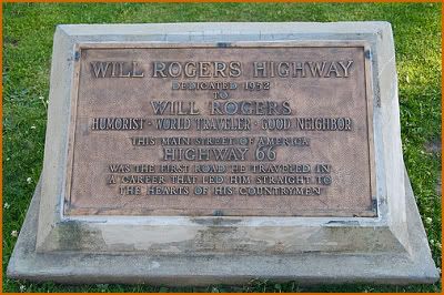
Santa Monica, California

Quote from Route 66 Preservation Foundation :
"Santa Monica" is the western terminus of Route 66. In 1926 when Route 66 was officially designated, the road was identified from Chicago to Los Angeles. In 1935 the road was extended from Sunset Blvd (Cesar Chavez Ave.) to Santa Monica Blvd. to Lincoln and ended at… but that’s another story, told by Dan Harlow (see below). When the Pasadena Freeway was completed a realignment of Route 66 took place and later when the 10 Freeway was completed another alignment was recognized. For a while Route 66 followed the Pasadena Freeway to the Hollywood Freeway to Santa Monica Blvd., to Lincoln etc.
Revived From A Desert Grave, Calico California

Quote from Legends of America:
Three miles north of Interstate-15, midway between Barstow and Yermo, California sits the historic and restored ghost town of "Calico", California.
It all began in 1875 when roving prospectors first found silver on the south slope of the Calico Mountains. However, it wasn�t until some five years later that additional ore discoveries worth $400 to $500 per ton brought about a small rush and the filing of many claims.
In the spring of 1881 came the discovery of the Silver King, Calico�s richest mine and less than a year later, the new settlement supported several businesses on a commercial street flanked by tents and adobe buildings on a narrow mesa between Wall Street Canyon and Odessa Canyon. It took its name from the myriad of colors in the mountains which are the backdrop for the town.


Goffs, California (on the Pre-1931 Alignment of Route 66)

Quote from Route 66 Preservation Foundation:
Route 66 once again rejoins the Interstate at Needles. A few miles down the Interstate the Hwy 95 exit brings you back to Route 66. This portion of the old road is the pre 1931 alignment of Route 66 and leads to the little desert community of "Goffs", California. The pre-1931 alignment of Route 66 was still used regularly after it was bypassed by the newer alignment of Route 66 in the 1930s. Travelers wishing to avoid the 5% grade of the new highway, and possible overheating, would take the older road with its 2% grade through Goffs.
In the early days of Needles, residents thought that Goffs was a nice place to go to beat the Mojave heat. Actually Goffs is a little higher in elevation than Needles, a fact that prompted residents of the Colorado River town to spend their summers here. They thought it was cooler in Goffs. Why melt in the 120-degree heat of Needles when you could enjoy the cool alpine temperature of 115 degrees in Goffs?
When you arrive in Goffs coming from the east the first thing you’ll notice is the Goffs General Store on the right. If you are lucky it will be open when you pass through. Street.
El Rancho Motel, Barstow California

Quote from The Road Wanderer:
Barstow is another Route 66 town that takes pride in its heritage. There is still much of Old Route 66 to see in Barstow. The famous El Rancho Motel, built with railroad ties from the defunct Tonopah & Tidewater RR, and El Rancho Cafe are Mother Road landmarks.
Route 66, Needles Area California

Quote from Route 66 Preservation Foundation:
As you enter "Needles" you will see the famous "Welcome to Needles Covered Wagon". It was formerly used as a sign for the El Rancho Hotel in Needles. Most of Route 66 through Needles is called Broadway Street.